![[UK map]](/img/locationmap.png)
| OSGB36 trig archive spreadsheet - IW | |||||||||||||
|---|---|---|---|---|---|---|---|---|---|---|---|---|---|
| Trig Name | Original Name | New Name | EASTING | NORTHING | HEIGHT | ORDER | TYPE OF MARK | Computing Date | CLASS OF LEVELLING | Date of Levelling | LEVELLING DATUM | DESTROYED MARK INDICATOR | COMMENTS |
| Cote Hill Observation Post | SE38/T22 | SE38T022 | 420796.47 | 457827.08 | 0.000 | 3 | CUT | 01/06/1955 | 0 | 1 | Cut in roof. Dest 1959 |
Nearby trigpoints, placenames
There are 4 photos for this trigpoint (view album).
This trigpoint:
Is ranked joint 21180th with 7 other trigs (more).
Has a mean score of 3.58/10 (from 12 logged visits)
Was First logged: 8th Jun 2014
Has never been found intact
Was Last logged: 16th Feb 2024
Of the 12 logged visits,
1 recorded a location
The error was 99m
You are not logged in. You must login if you wish to log a visit.
![]() 16th Feb 2024 16:30 by swampysean
16th Feb 2024 16:30 by swampysean
FB Number: Not logged Condition: Destroyed Score: 2/10
Near to some big balls
![]() 16th Feb 2024 16:30 by craftinessa
16th Feb 2024 16:30 by craftinessa
FB Number: Not logged Condition: Destroyed Score: 5/10
![]() 20th Feb 2023 08:45 by Mickandkim
20th Feb 2023 08:45 by Mickandkim
Gridref: SE 20700 57800 FB Number: Not logged Condition: Destroyed Score: 1/10
Gone
![]() 19th Jun 2021 16:52 by peregrinus
19th Jun 2021 16:52 by peregrinus
FB Number: Not logged Condition: Destroyed Score: 5/10
Gone.
![]() 20th Jan 2020 17:29 by FrankR
20th Jan 2020 17:29 by FrankR
FB Number: Not logged Condition: Destroyed Score: 3/10
Drive by. Didn't seem worth trying to park and search if it's gone.
![]() 10th Nov 2019 10:20 by eon
10th Nov 2019 10:20 by eon
FB Number: Not logged Condition: Destroyed Score: 2/10
(1588) Reported destroyed in the 50s. Viewed general location only.
![]() General area. ©eon
General area. ©eon
![]() 14th Jul 2017 10:53 by Ant1974
14th Jul 2017 10:53 by Ant1974
FB Number: Not logged Condition: Destroyed Score: 5/10
![]() 2nd Jun 2016 11:50 by BasilDowl
2nd Jun 2016 11:50 by BasilDowl
FB Number: Not logged Condition: Destroyed Score: 5/10
Retrospective log, after realising I must have virtually walked over the top of where this was on my way to bag the Stone Beds pillar. The security next to the ROW is something else.
![]() 10th Apr 2015 15:30 by tigger4242
10th Apr 2015 15:30 by tigger4242
FB Number: Not logged Condition: Destroyed Score: 5/10
Drive by, did not stop
![]() 30th Jul 2014 11:50 by dugswell2
30th Jul 2014 11:50 by dugswell2
FB Number: Not logged Condition: Destroyed Score: 5/10
Had a walk down ROW after bagging trig then 10 minutes later was stop on the road by the police to check on what I had been photographing near Menwith Hill Camp.
![]() 26th Jul 2014 09:05 by ted
26th Jul 2014 09:05 by ted
FB Number: Not logged Condition: Destroyed Score: 0/10
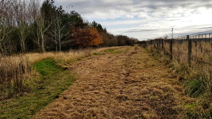
Footpath alongside the security fence but nothing to see.
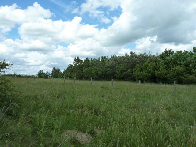
![]() Cote Hill site
Cote Hill site
![]() 8th Jun 2014 13:10 by CJO
8th Jun 2014 13:10 by CJO
FB Number: Not logged Condition: Destroyed Score: 5/10
No sign of even any remains on or adjacent to the PROW. Too many CCTV cameras to go too far off piste.
![[map]](/img/trig-map.png.php?t=17469&b=2&l=0&)